Graphic Visualizations
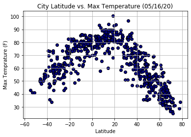
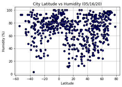
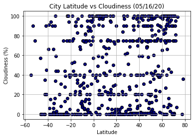
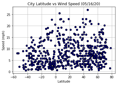
In this project, I analyzed weather patterns based on distance to the equator. I applied Python script to visualize the weather of 500+ cities across the world of varying distance from the equator. To accomplish this, I utilized a simple Python library, the OpenWeatherMap API to create representative models of weather across world cities. I first retrived a dataset of more than 500 cities using the citipy python library and python to randomly generate coordinates to get the nearest cities. Then I applied the list of cities to get their weather by using the OpenWeatherMap API. In the module of MatPlotLib, I used each city's maximum temperature, humidity, cloudiness, or wind speed and plotted their data with the latitude on the graph.